
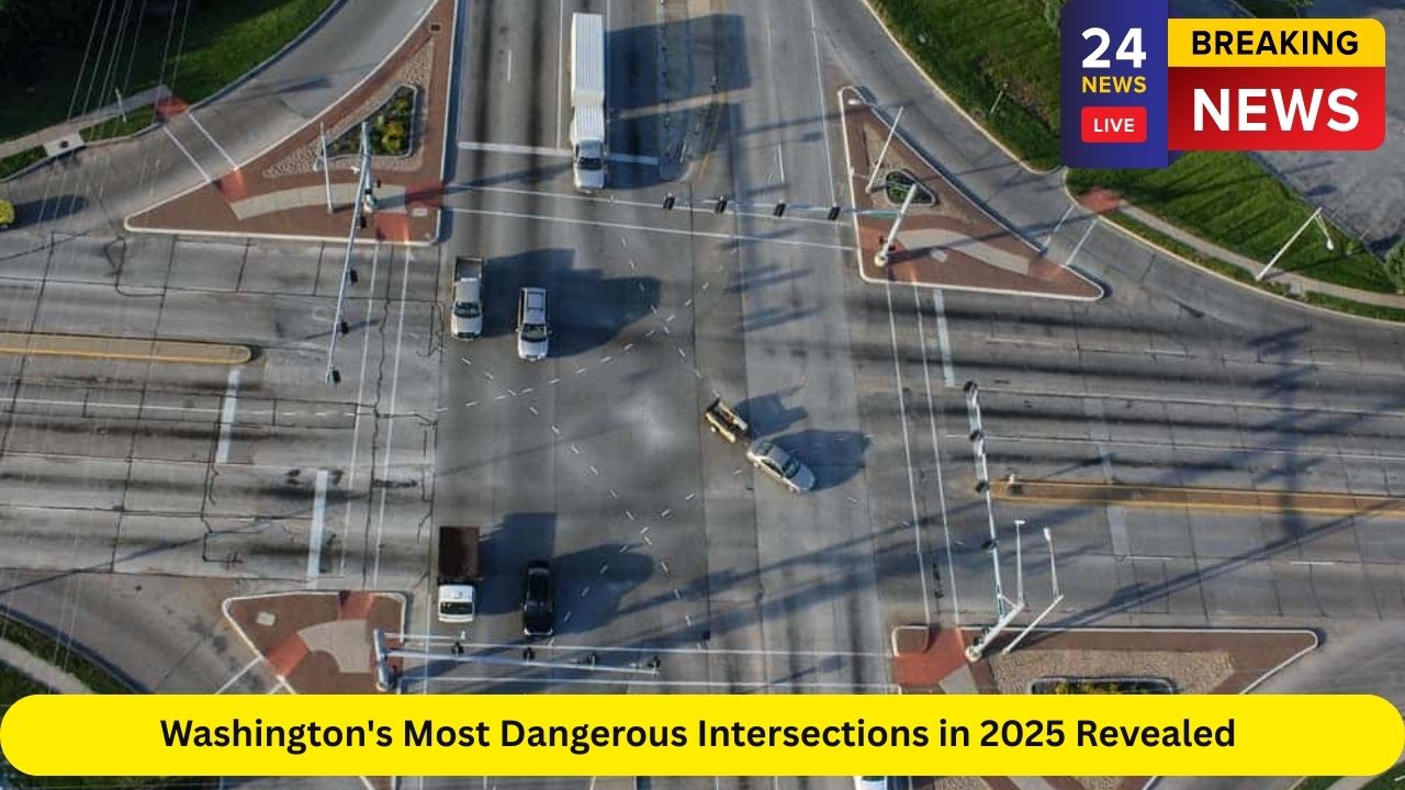
Washington state is known for its scenic roadways, but beneath the beauty lies a reality few drivers think about—dangerous intersections that are more prone to crashes, injuries, and even fatalities. In 2025, transportation data has highlighted several intersections throughout the state that have become hotspots for accidents. From roundabouts in Lake Stevens to high-traffic zones in Kent, these areas are drawing attention from both local authorities and commuters alike.
This long-form guide dives into which intersections are causing the most concern, why they’re dangerous, and what’s being done to improve safety. If you live in cities like Everett, Kent, Spokane, Lake Stevens, or Seattle, there’s a good chance you’ve passed through one of these high-risk spots. Read on to see if your neighborhood made the list.
How “Most Dangerous” Is Defined
The term “most dangerous intersection” isn’t just based on perception—it’s backed by data. Transportation experts use several key indicators to assess risk levels at intersections across the state:
Crash frequency: Total crashes recorded over multiple years
Injury severity: Number of serious injuries or fatalities
Traffic volume: How many vehicles pass through the intersection daily
Accident rate per vehicle: Crashes adjusted for traffic flow
Proximity to schools, businesses, or freeways
Driver behavior data: Speeding, distracted driving, and failure to yield
This combination of metrics helps transportation officials identify not only where crashes happen but why they happen.
Most Crash-Prone Intersections in Washington
SR 204 & SR 9 Roundabout – Lake Stevens
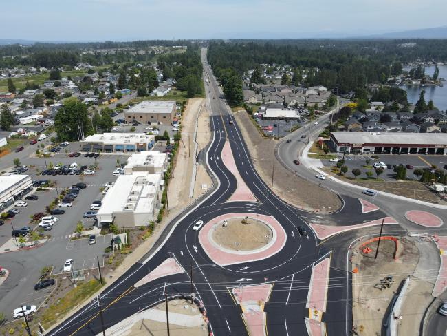
In 2024, a roundabout was introduced at this busy intersection. While designed to improve long-term traffic flow and reduce severe crashes, the transition period saw a sharp increase in minor collisions and driver confusion. This location has become notorious for side-swipes and yield violations, especially during rush hour.
108th Ave SE & 208th St SE – Kent
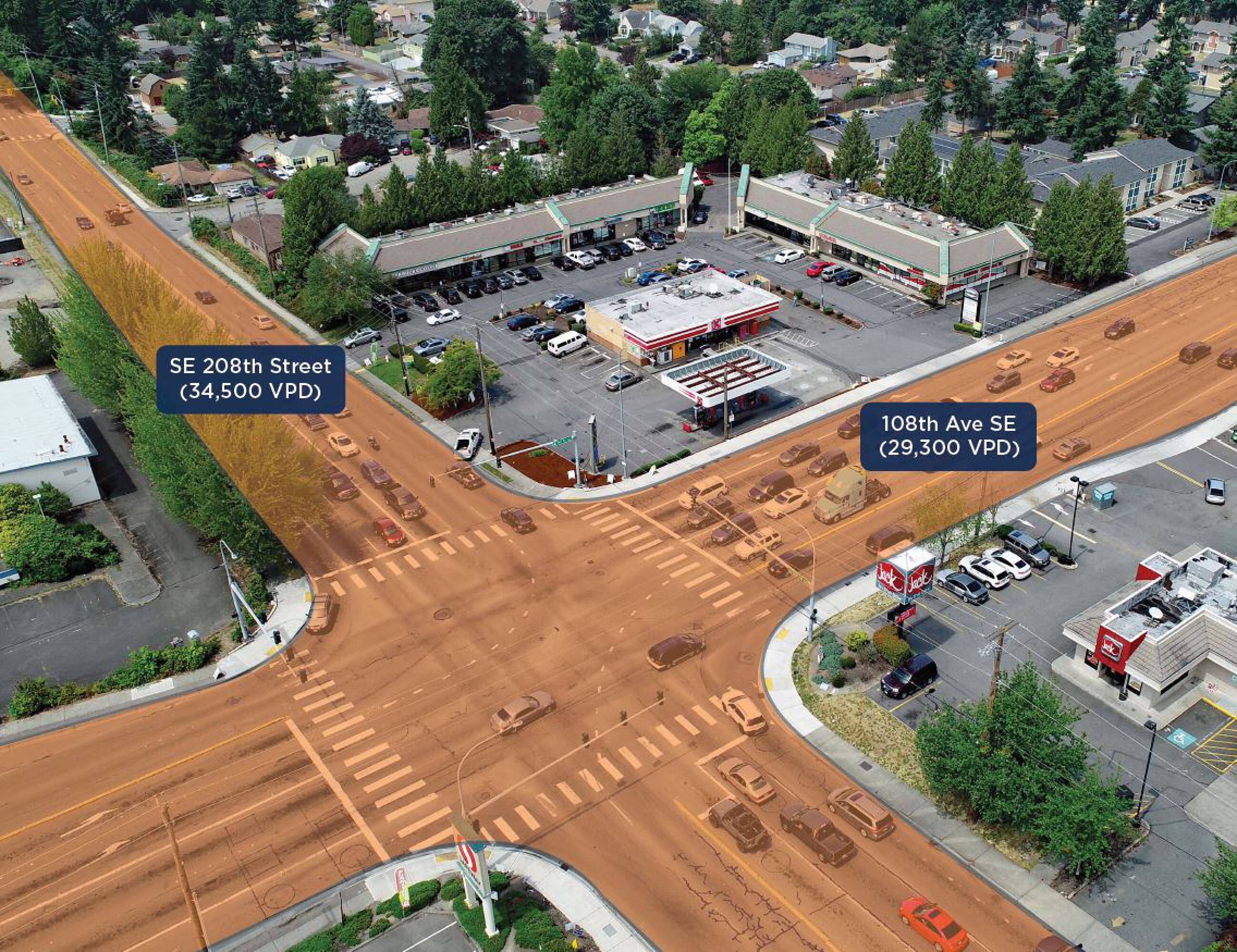
This intersection has consistently recorded high numbers of accidents due to merging traffic from nearby highways and busy commercial centers. A lack of designated turn lanes and poor visibility during rain or fog contribute to the risk.
116th SE & SE Kent Kangley Rd – Kent
Serving as a key connector for local neighborhoods, this intersection struggles with congestion and quick signal changes. Fast-moving commuters often collide with slower vehicles trying to turn or merge, resulting in dozens of injury crashes each year.
84th Ave S & S 212th St – Kent
Another Kent intersection that has seen a high number of accidents in recent years. The layout encourages red-light running and aggressive lane shifting during evening rush hour. Multiple injury crashes have led city planners to reevaluate timing sequences here.
112th SW & Evergreen Way – Everett
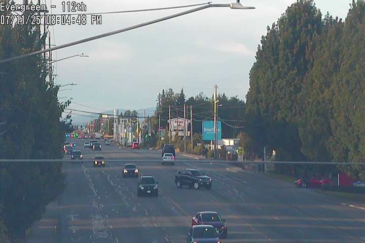
This busy Everett intersection is surrounded by retail and pedestrian activity, making it one of the most dangerous in Snohomish County. Left-turn collisions and pedestrian strikes are common, particularly during weekends and holidays.
Other Noteworthy Dangerous Intersections
Several other intersections around the state have raised alarms among transportation safety advocates:
39th Ave SW & 9th St SW – Puyallup
Located near schools and retail outlets, this intersection combines young drivers, distracted shoppers, and fast-moving traffic. It sees a disproportionate number of rear-end and angle crashes.SR 204 & Vernon Rd Roundabout – Lake Stevens
Newly constructed, this roundabout has contributed to confusion among drivers unfamiliar with multi-lane roundabout rules. Minor accidents have increased, though severe injuries remain rare.SR 395 & Clearwater Ave – Kennewick
A known hotspot for aggressive driving and late-night accidents, this intersection is under review for safety improvements.Airport Way S & S Spokane St – Seattle
With heavy truck traffic and port-bound vehicles, this industrial corridor has seen rising accident rates, especially during the early morning and late-night shifts.
Patterns Across Washington State
Many of the most dangerous intersections share similar traits:
High-speed merging from freeways into urban arterials
Complex traffic signal phasing that confuses unfamiliar drivers
Inadequate signage or poorly marked lanes
Heavy pedestrian or cyclist presence in commercial zones
Weather challenges, especially in western Washington where rain and fog are frequent
The combination of population growth, outdated infrastructure, and aggressive driving habits has turned many once-manageable intersections into daily hazards.
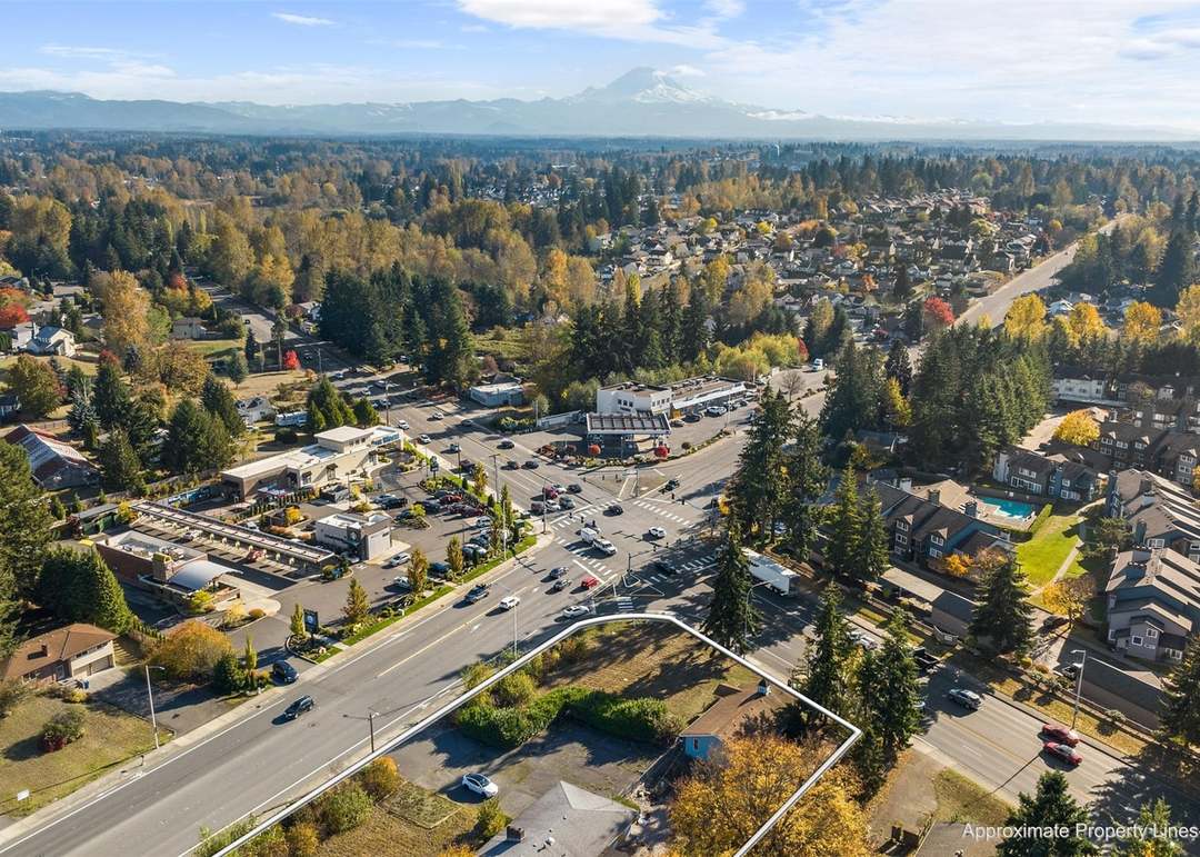
Kent’s Growing Traffic Problem
Kent has emerged as a focal point in 2025’s intersection crash data. With rapid suburban growth, booming commercial zones, and limited street expansion, Kent’s arterial roads have become overwhelmed. Three of the state’s five worst intersections are located here.
Local efforts include improving left-turn lanes, adding more visible pedestrian crossings, and installing speed feedback signs. However, infrastructure updates often lag behind population growth, and many intersections continue to pose risks.
Lake Stevens and the Roundabout Dilemma
Lake Stevens introduced multiple roundabouts in 2024 to ease congestion on SR 204 and surrounding roads. While early studies suggested reduced fatal crash rates, local residents have reported a surge in minor accidents. The main issue appears to be a lack of familiarity—especially with two-lane roundabouts that require lane discipline and signaling.
Public education efforts have included driver safety videos, community meetings, and better signage. Officials remain confident that over time, the crash rate will stabilize or decline.
Everett’s Pedestrian Problem
In Everett, intersections like 112th SW & Evergreen Way are under scrutiny due to their mix of fast-moving traffic and pedestrian activity. Retail-heavy corridors attract foot traffic, but crosswalks and signals haven’t been adequately updated to reflect the risk.
City planners are exploring raised crosswalks, pedestrian islands, and reduced speed limits in high-traffic zones.
Summer: The 90 Most Dangerous Days
The period between Memorial Day and Labor Day is often referred to as the “100 Deadliest Days” nationally, and Washington state is no exception. Warmer weather brings more drivers, cyclists, and pedestrians to the roads, increasing crash likelihood across all intersections.
From June through August:
More alcohol-involved crashes occur
Teen driver accidents spike due to school being out
Motorcyclists are more vulnerable due to increased road use
Pedestrian traffic increases in commercial and recreational zones
The state often sees a 25–35% increase in intersection-related collisions during these three months compared to the winter period.
What Washington Is Doing to Make Intersections Safer
Local and state agencies are working on several fronts to tackle the rising crash rates:
Signal Retiming: Upgraded lights that reduce yellow-light dilemma zones and coordinate with traffic volume
Roundabout Redesigns: Better lane markings, overhead signage, and pedestrian crossings
Speed Enforcement: More red-light cameras and speed traps in known high-crash zones
Infrastructure Grants: Cities like Kent and Everett have applied for state and federal funding to redesign busy intersections
Driver Education: Public campaigns focusing on roundabout navigation, distracted driving, and yielding to pedestrians
Tips for Safer Driving in High-Risk Intersections
Whether you’re driving through Spokane, Kent, or Tacoma, here are some best practices to help you avoid becoming a statistic:
Slow down when approaching intersections, even if the light is green
Avoid distractions—especially cellphones—when navigating complex or unfamiliar layouts
Give way in roundabouts and never change lanes mid-circle
Watch for pedestrians even when no crosswalk is present
Be cautious at dawn and dusk, when visibility and attention are often low
Future Outlook for Washington’s Roads
As population growth continues, particularly in cities like Kent, Lake Stevens, and Spokane Valley, the need for modernized intersection design becomes more urgent. The Washington State Department of Transportation (WSDOT) and local agencies are shifting their focus toward:
Smart traffic signals that respond to real-time conditions
Pedestrian-priority designs in urban and suburban zones
Expanded public transit routes to ease road volume
Data-driven planning using crash heatmaps to identify new danger zones
With infrastructure funding and innovative design strategies, many of today’s most dangerous intersections could become safer by the end of the decade.
Conclusion
Whether you’re a long-time resident or just passing through, it’s important to be aware of Washington’s most dangerous intersections in 2025. These high-risk spots aren’t just statistics—they’re everyday places where people live, work, and travel. Knowing where danger lies is the first step toward staying safe.
Drivers, pedestrians, and cyclists alike must be more aware and cautious—especially in cities like Kent, Lake Stevens, and Everett, where traffic conditions are evolving rapidly. As infrastructure catches up with demand, and awareness campaigns gain traction, the hope is that future rankings of dangerous intersections will feature fewer familiar names.
Until then, drive safe, stay alert, and never assume others are paying attention—especially at that next light.


Leave a Reply