

MTA Above-Ground Subway and Limited Metro-North Service Restored
Metro-North Will Resume Limited Hourly Service at 6 p.m. until 11 p.m. on the Hudson, Harlem and New Haven Lines
Staten Island Railway Service Fully Restored; Express Subway Service in New York City Starts 7 a.m. Wednesday
New York City Bus Service Remains Active but Limited; Expected to Begin Running Normally on Wednesday at 5 a.m.
Full Travel Ban in Effect on I-84 from Pennsylvania to Connecticut Border and Tractor Trailer Ban Remains on I-87 from Albany to Canadian Border
Tractor Trailer Ban Still in Effect on the Thruway, I-81, I-84, I-86/Route 17, I-88 and I-87 from Albany to Canadian Border
Full Travel Ban in Broome County Still in Effect
Governor Andrew M. Cuomo today announced that MTA above-ground subway and limited Metro-North service will be restored on Tuesday evening at 6 p.m. At this time, Staten Island Railway service has been fully restored and express subway service will begin Wednesday by 7 a.m. or earlier on all lines.
Metro-North will resume limited hourly service starting at 6 p.m. tonight until 11 p.m. on the Hudson, Harlem and New Haven Lines, although there will be no branch service. The Hudson branch will run to Croton-Harmon only; the Harlem line runs to North White Plains; and the New Haven line ends at Union Station tonight. Full service will resume Wednesday morning per the regular weekday schedule and all customers will be served within five minutes of their normal departure time.
The Long Island Rail Road continues to operate a normal schedule with scattered delays. New York City bus service will begin running normally on Wednesday at 5 a.m. and the Access-a-Ride paratransit service has already started taking reservations for tomorrow’s commute.
“As the severity of weather conditions decrease, we are restoring MTA above-ground subway and limited Metro North service so New Yorkers can resume their routines,” Governor Cuomo said. “The state is responding quickly to changing weather conditions, and we encourage New Yorkers to stay home where possible and continue exercising caution as we ride out the storm.”
The Governor also announced today a full travel ban on I-84 from the Pennsylvania border to the Connecticut border, as well as a tractor trailer ban on I-87 between Albany and the Canadian border, which went into effect at 1 p.m. Only emergency personnel, first responders, and other critical healthcare personnel will be permitted on the roadway. A temporary tractor trailer ban still remains in effect on I-81, I-84, I-86/Route 17, I-88 and on all of the New York State Thruway. The full travel ban for all of Broome County announced earlier today remains in effect. More information is available here.
Blizzard and Winter Storm Warnings
Central New York, Western Mohawk Valley & Southern Tier
The most intense area of the storm has shifted to the Southern Tier region. Expected snow accumulation for Broome County is now 30 to 35 inches. Current on the ground snow reports range from 12 to 20 inches across the Southern Tier and Catskills. Snow accumulation for the Binghamton area is now estimated to be around 18 to 24 inches. Snow accumulation for Monticello/Southern Catskills area will be around 24 to 30 inches. Snow accumulation for Ithaca/Elmira/Rome areas will be around 12 to 18 inches. The Syracuse/Auburn/Oneonta areas will see accumulations around 18 to 24 inches. Wind will be out of the north at 11 to 15 mph with gusts as high as 30 mph. Winds may cause blowing and drifting snow. Temperatures are in the mid-20s.
Winter Storm Warning: Broome; Chemung; Chenango; Cortland; Madison; Northern Oneida; Onondaga; Oswego; Otsego; Schuyler; Seneca; Southern Cayuga; Southern Oneida; Steuben; Tioga; Tompkins; and Yates Counties until 8:00 p.m. Wednesday
Blizzard Warning: Delaware and Sullivan Counties until 11:00 p.m. today
Capital District, Eastern Mohawk Valley & Upper Hudson Valley
Snow accumulations of 18 to 24 inches is possible. Current on the ground snow reports range from 8 to 12 inches. Most of the area today cloudy skies are forecast with scattered snow showers. Heavy snow showers likely after 7:00 a.m. Winds will be out of the north at 7 to 18 mph. Temperatures will be in the low 20s with a high near 26. Areas of dense freezing fog after 9:00 a.m. Areas of blowing snow after 3:00 p.m. The snow could be heavy at times with areas of blowing snow. Winds will be out of the east at 14 to 16 mph. Wind chill value as low as -5.
Blizzard Warning: Columbia; Dutchess; Greene; Ulster in effect until 12:00 a.m. Wednesday
Blizzard Warning: Albany; Rensselaer; Schenectady; Warren; Washington; Schoharie; Saratoga in effect until 4:00 a.m. Wednesday
Winter Storm Warning: Albany; Rensselaer; Schenectady; Hamilton; Montgomery; Fulton; Herkimer; Warren; Washington; Schoharie; Saratoga in effect until 8:00 p.m. Wednesday
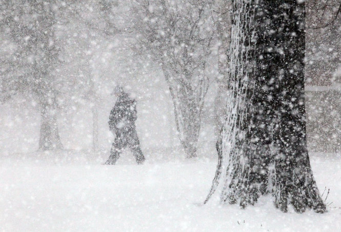
Lower Hudson Valley, NYC & Long Island
Accumulations potentially as high as 24 inches north of New York City. Current on the ground snow reports range from 4 to 12 inches. Temperature high in the upper 20s. Winds northeast 25 to 35 mph, with wind gusts as high as 50 mph. Tonight, cloudy, snow and freezing drizzle before 10:00 p.m., with a change of snow between 10:00 p.m. and 3:00 a.m. along with areas of blowing snow before midnight. Wind chill values between 10 to 15 degrees. Wind gusts as high as 33 mph. There is little or no ice accumulation expected. Wednesday, mostly cloudy with a high near 30. Scattered snow showers, mostly after 11:00 a.m. Wind chill between 10 and 15. Northwest winds 10 to 16 mph.
Flood Advisory: Nassau, Queens, Suffolk (Issued at 10:11 AM; Expires at 1:14 PM)
Coastal Flood Warning: Southern Nassau until 2:00 p.m. Tuesday. Northeast Suffolk and Southeast Suffolk County until 4:00 p.m. Tuesday. Minor to moderate coastal flooding is expected around the times of high tide this afternoon.
Winter Storm Warning: Suffolk County until 12:00 a.m. Wednesday.
Western and Northwestern New York
Snow accumulations of 10 to 16 inches is possible. Current on the ground snow reports range from 1 to 4 inches. Winds will be from the north at 16 to 20 mph. The snow could be heavy at times with areas of blowing snow after noon. Temperatures in the high teens low 20s. For most of the area tonight mostly cloudy skies are expected with snow showers. New snow accumulation of 10 to 16 inches possible in the Rochester, Oswego and Thruway corridor. A possible 10 to 16 inches expected in the city of Buffalo. Temperatures in the low teens around 12. Winds for the northwest around 18 mph with gusts as high as 28 mph. Tomorrow forecast expected snow showers. Areas of blowing snow. Winds from the northwest at 16 to 22 mph with gusts as a high as 33 mph.
Winter Storm Warning: Niagara; Orleans; Monroe; Northern Cayuga; Wayne; Oswego; Jefferson; Lewis; Genesee; Erie; Wyoming; Allegany; Livingston; Ontario; Cattaraugus; Chautauqua in effect until 8:00 p.m. Wednesday
Northeastern New York
Snow accumulations of 8 to 24 inches is possible. Current on the ground snow reports range from 1 to 3 inches. Temperature high 20 degrees, low 5 to 15 degrees. Winds are northwest around 16 mph, with wind gusts as high as 32 mph. Snow totals of 8 to 12 inches in St. Lawrence, 18 to 24 inches expected in Central Franklin, Clinton and Essex counties.
Winter Storm Warning: Clinton, Essex, Franklin, St Lawrence Counties until 8:00 p.m. Wednesday
Blizzard Warning: Clinton, Essex, Franklin, St. Lawrence Counties until 11:00 a.m. Wednesday